
Vistas, history and a slice of rural England await hikers to the Peak District's Mam Tor
CASTLETON, England (AP) — Finally, a sign I couldn’t miss or misunderstand.
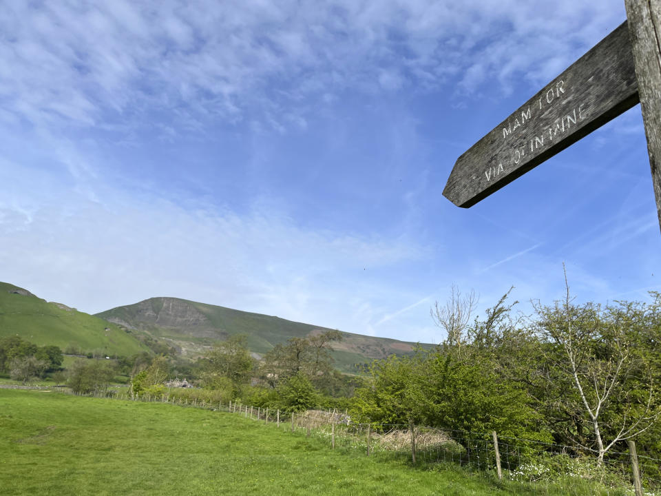
It read, “Mam Tor via Odin Mine.” As we followed the line of the arrow on the sign, there it was, the popular Mam Tor (Mother Hill), off in the distance, looming above the Hope Valley and beckoning hundreds of hikers to climb to the top on this warm, windy spring day.
“It looks like a bunch of ants walking in a line across the top,” said my sister, Lauren, pointing to the faraway figures moving in a line along the ridge extending east from Mam Tor. Soon enough, we’d join the procession.
This was Day Three of our six-day hike through England’s Peak District National Park. Somehow, despite my protests, I had been appointed lead ant. My wife (Susan), my sister and her husband (Bob) followed my directions, starting the hike at Buxton, then on to Tideswell (13 miles) and Castleton (11 miles), near the base of Mam Tor.
Several cities and towns in the district make good starting points for multi-day hikes of the Peak District and are just a two- or three-hour train ride from London. The nearest train station to Castleton is Hope, only a couple miles away.
The district is known for picturesque landscapes, limestone ridges and mineral waters, (Among those frequenting Buxton's thermal spas over the centuries was Mary Queen of Scots.) It was England's first national park, created in 1951, and is a popular hiking and camping destination for U.K. residents. Outside of England, it's not as well known as the coastal paths in Cornwall, or the Cotswold Way. That's a shame.
On our way to Castleton, we traversed fields full of sheep and edged by limestone walls. We navigated the muddy banks and stepping stones of the winding Wye River, and walked up and down a succession of hills. We went astray three or four times, helped back to the straight and narrow path by helpful farmers, fellow hikers and a bit of luck.
As we neared Castleton, we carefully walked down Cave Dale, a rock-and-boulder-filled gorge created thousands of years ago by melting glaciers. We arrived in the little village and … discovered it was still another kilometer or so to Dunscar Farm, a working sheep farm and our bed-and-breakfast for the next two nights.
While I silently (OK, not so silently) mumbled about the extra kilometer after the long day’s hike, the quaintness of the farm and the kindness of our hosts (we ate farm-fresh eggs for breakfast and they did a load of laundry for us) more than made up for the extra steps.
Setting out
The next morning, as we headed off in search of Mam Tor, there was the sign — “Mam Tor via Odin Mine” — only a hundred yards from Dunscar Farm. There’s nothing better and more reassuring than a sign that points to a destination you can see.
Mam Tor is 517 meters high (1,696 feet), not the tallest peak in the district but one of its most popular (Kinder Scout is 636 meters, or 2,097 feet high). There’s plenty of geology, stunning views and history here.
Stone tools were found in the caves dating back to the Paleolithic Period (500,000–8,000 B.C.). And more than 3,000 years ago, one of Britain’s “most spectacular prehistoric hillforts topped Mam Tor,” according to the museum in Castleton’s tourist information office.
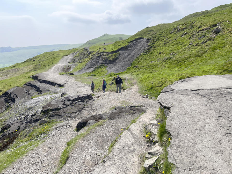
The history is wonderful, but we were here for the views, and off we went, past the Odin Mine — where they mined lead from the 13th to the 19th centuries — to the start of the Broken Road.
Mam Tor is called Mother Hill because frequent landslides (or landslips as they call them here) caused by unstable layers of shale resulted in a series of smaller “baby” hills forming beneath it. All these shivers and shakes wreaked havoc on the A625 road on the eastern side of the hill and led to a second nickname: the Shivering Mountain.
For years, British engineers and highway workers patched the convulsed rural road, finally giving up and closing it to vehicle traffic in 1979.
“It looks like lava flowing down the hill,” Bob said as we made our way past sections of broken concrete, some more than 2 feet thick.
On up to the peak...
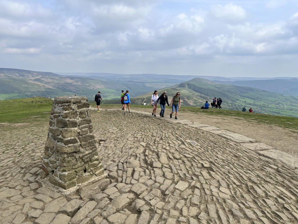
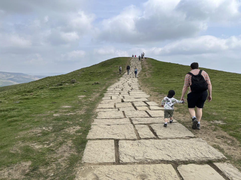
The Broken Road ends at the start of the stone and flagstone steps leading to the top of Mam Tor. Several hang gliders were taking off nearby, soaring and landing in a parking lot.
The steps were steep, but it wasn’t an especially hard hike, and the views extended further the higher we marched. A little stone pyramid at the top marks the peak, and a steady stream of hikers of all ages, many with dogs, were taking selfies and photos there. Some people picnicked, some headed back down the way they came.
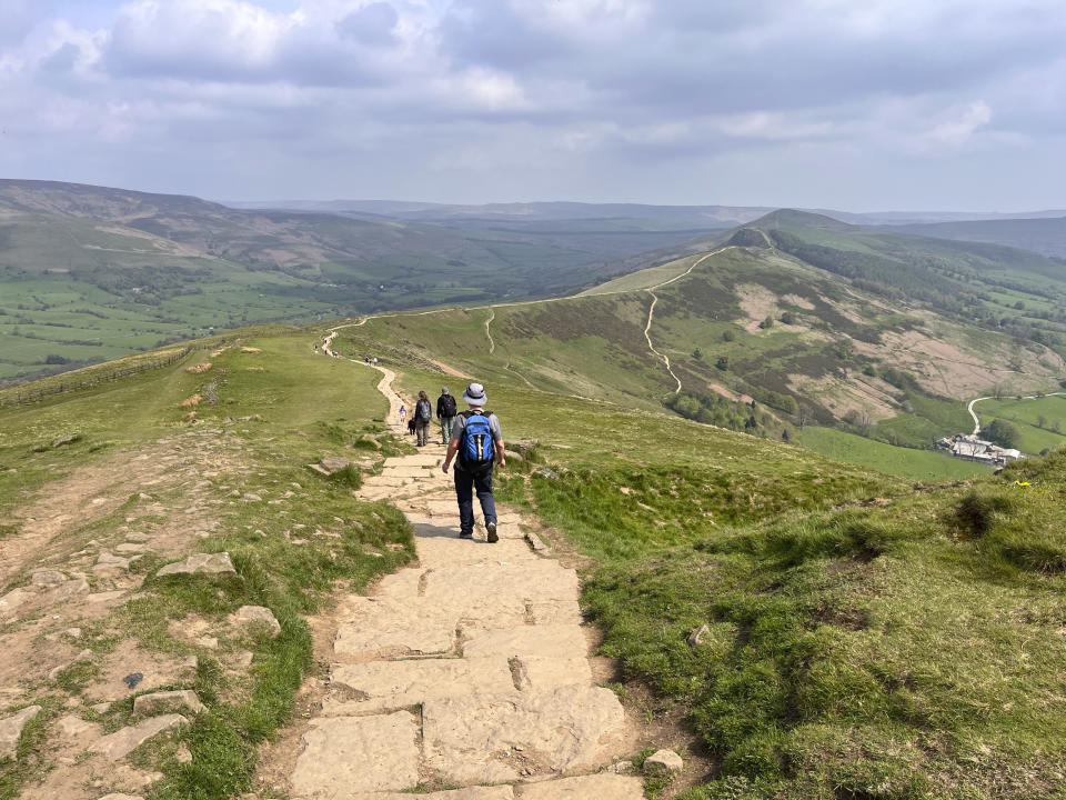
We headed the other way, east along the Great Ridge to Hollins Cross, the lowest point on the ridge, and then up, up, up the rocky steps toward Lose Hill, roughly 2 miles from Mam Tor and about as high. The views of the Edale Valley to the left and the Hope Valley to the right are said to be among the best in all of Britain. I’m not about to dispute this.
Large birds of prey put on a show, hovering at eye level and then diving down along the ridge in search of a meal. Later, looking at a poster of local birds of prey at Dunscar Farm, we decided they were red kites.
The road back to town and pub
After Lose Hill, the path along the ridge ends, and it was time to descend and head back to Castleton.
We spotted the remains of Peveril Castle in the distance. It's one of Britain’s oldest Norman fortresses; the keep was built by Henry II in 1176.
We kept the castle in sight as we hiked the final mile to Castleton. Just below the ruins is The George, our pub of choice and the perfect place to spend the evening discussing the day’s spectacular 7-mile hike.
—-
For more AP Travel stories, go to https://apnews.com/hub/travel
