
Why bagging a Marilyn is as good as a Munro: our pick of British hills
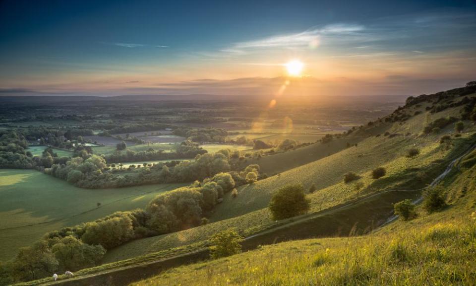
‘Well,” I thought, as I stood by a concrete trig point on a summit, looking down over vast tracts of verdant Sussex Weald, “this feels like a proper hill.” And so it should, given that 248-metre Ditchling Beacon is the highest point in East Sussex and the third-highest in the South Downs. But what’s of even greater significance is that this hill is a Marilyn – a designation that says more about a peak than height alone.
The term was coined by cartographer and keen outdoorsman Alan Dawson. “I was bagging hills in the Lake District,” he told me from his home near Loch Tay. “I came off 3,000ft Skiddaw and went downhill to bag Sale How, at 2,000ft, and thought, ‘Well [going downhill to bag a summit], that’s a bit daft.’”
And so the Marilyn was born: a category of hills and mountains that rise at least 150 metres (almost 500ft) above everything else in their immediate vicinity – in other words, walkers can head down from the summit 150 metres in any direction and not meet another hill or ridge. In some cases, it may not even matter if there are higher hills close by – all that matters is whether it’s possible to drop down 150 metres in all directions from the top. Thus, a Marilyn will always offer a decent ascent to the summit.
However, because there’s no fixation on their overall altitude (though Ben Nevis is also a Marilyn), there are Marilyns that almost anyone can bag. The lowest one in England, for instance, is Cumbria’s Arnside Knott (see box) which is just 159 metres high, and the lowest in Britain is Maol Domhnaich a tiny Hebridean island where the summit is at only 154 metres.
The Ordnance Survey (OS) doesn’t keep data on the relative prominence of hills, so the only way Dawson could collate the Marilyns – there are 1,557 in Britain and the Isle of Man – was by laboriously scouring all 204 OS Landranger maps.
“They weren’t even metric at the time,” he told me with a pained laugh, “they had contours at 50ft intervals.” In all, it took six years before the publication of his definitive Marilyns guide, The Relative Hills of Britain. Irish writer and climber Clem Clements has since located all the Irish Marilyns, adding another 454 to the pot. Marilyn is Dawson’s playful nod towards the best-known class of mountain: the Munro, Scotland’s mighty 3,000ft-plus (914-metre) peaks.
Map duly packed, a friend and I cycled the seven miles from the county town of Lewes to lock up our bikes at the foot of Ditchling Beacon. It’s one of just half a dozen Marilyns in the South Downs, the chalk ridges that stretch for 100 miles across Hampshire and Sussex. In 20 minutes we had clambered to the summit through the wooded nature reserve that clings to the hill’s scarp slope, its narrow path a stream of thrillingly slippery clay. As its name suggests, for many years Ditchling Beacon was used for a signal fire that could be seen from far and wide, and our sharp ascent was generously rewarded with a fantastic panorama across the plain to the North Downs.

We now only needed to climb another 599 Marilyns and we could apply to join the Relative Hills Society’s Marilyn Hall of Fame. Only 10 people are credited with having climbed all 1,557, and we doffed our hats to them as we gulped down hot drinks and lungfuls of fresh Sussex air on the summit before embarking on a breezy, four-mile, circular stroll by bridleway and footpath. This took us beside the remains of an iron age fort, past Big Bottom (no sniggering – practically all the valleys in these parts are “bottoms”) and down through pastureland and wind-scattered rooks. Then it was time to ease ourselves up Ditchling Beacon’s gentle lee slope, with the windmills known as Jack and Jill, a well-loved local landmark, down the hill to our left.
Every good winter walk needs a cosy cafe at its end. Once we’d slithered back down to the foot of the hill, we cycled a mile to the village of Ditchling and the Nutmeg Tree for some warming coffee and calorie-drenched hunks of vegan chocolate fudge cake. Settled in by a woodburning stove, we speculated as to whether Britain’s hills and mountains were the most catalogued land forms on the planet. In addition to Marilyns, you can walk up HuMPs, TuMPs, Simms, Corbetts, Munros, Murdos, Grahams, Donalds, Furths, Hewitts, Nuttalls, Wainwrights, Birketts, Deweys, Dodds, Hardys and more. Indeed, Dawson’s next book – out at the end of the year – will focus on two further categories: P600s and P700s. These are classes of “super Marilyns” that tower 600 or 700 metres above all that surrounds them. There are, quite clearly, three certainties in life: death, taxes and a never-ending supply of hills to bag.
• Ditchling Beacon is 3½ miles from Hassocks station, served by bus no 167 from Hassocks and Lewes stations. The 79 bus runs at weekends and on public holidays from Brighton to the summit – but that’s hardly the spirit
More Marilyns and prominent peaks in Britain

Arnside Knott, Cumbria
Height: 159 metres above sea level, prominence: 151 metres
Proof that climbing a Marilyn need not be overly strenuous, this spot just south of the Lake District national park is one of Cumbria’s lesser-climbed hills. The only companions on its sylvan slopes may be the cattle grazed there by the National Trust. At the easily gained summit, take in a 360-degree view featuring Morecambe Bay, the Yorkshire Dales and Lakeland’s southern fells, before repairing to the estuary-side Albion pub down below in Arnside.
• Getting there: 30-min walk from Arnside station on the Furness Line
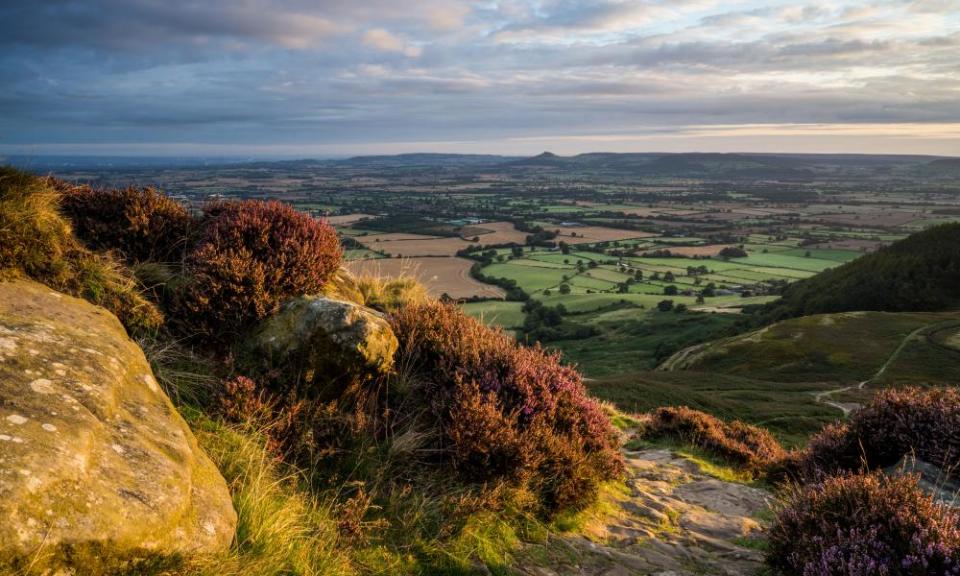
Cringle Moor, North Yorkshire
Height: 434m, prominence: 175m
Those hiking the Cleveland Way or doing the Lyke Wake Walk will have almost climbed Cringle Moor. The path that snakes its way around the dramatic northern ridge of the North York Moors passes just below the crest. However, make that short push to the summit and check out Drake Howe, a bronze age burial mound.
• Getting there: from Northallerton, take the no 89 bus to Carlton in Cleveland; Cringle Moor is a three-mile walk away
Fan Fawr, Powys
Height: 734m, prominence: 295m
A friendly green giant in the Brecon Beacons, Fan Fawr looks more like an overgrown hill than a proper mountain. It’s a simple, direct walk on paths up over Bryn Du to the summit. Once there, look smugly across to the distinctive outlines of Corn Du and Pen y Fan, which will almost certainly be more crowded.
• Getting there: from Merthyr Tydfil take the T4 or T14 bus to the Storey Arms outdoor centre

Long Mynd, Shropshire
Height: 517m, prominence: 193m
Marilyns come in all shapes and sizes – the Long Mynd, for instance, is a full seven miles long and three miles wide. Following the signposted Jack Mytton Way, the route up the Carding Mill valley from the market town of Church Stretton gradually builds the suspense until, with a last heave, walkers emerge blinking on to the mighty ridge. Then it’s a sumptuous, mile-long hike to the viewtastic summit at Pole Bank.
• Getting there: walk from Church Stretton station, which has trains to Manchester and Cardiff
Cnoc Mor, Ross and Cromarty
Height: 269m, prominence: 164m
Just outside the village of Strathpeffer, several footpaths pierce the dense pines of Blackmuir Wood. Choose a leisurely or a more abrupt ascent to the Cat’s Back ridge, from where it’s a short pull up to the summit for views of Loch Ussie and the Cromarty Firth. On your return, take in the Touchstone Maze, where 81 rocks chosen from around northern Scotland align with the solstices.
• Getting there: no 27 or 700 bus from Dingwall to Strathpeffer
Moel Siabod, Conwy
Height: 872m, prominence: 600m
Just qualifying as a P600 (prominence of 600 metres or more), Moel Siabod is the tallest mountain in Snowdonia’s Moelwynion range. The easiest ascent begins at the Plas y Brenin national outdoor centre, passing through a large Forestry Commission plantation and up the northern face. The prize at the top is a spectacular view – it’s said 13 of the highest peaks in Wales can be seen on a clear day.
• Getting there: from Betws-y-Coed station, take the S2 bus to Capel Curig
Kit Hill, Cornwall
Height: 334m, prominence: 171m
One of five Cornish Marilyns, Kit Hill is at the heart of a 400-acre country park. Neolithic and bronze age burial mounds testify that this was once a sacred site. More recently, quantities of silver, tin, copper and tungsten have been extracted from multiple mines. Their remains can still be seen today, alongside a lofty Victorian chimney stack at the summit that once served a steam engine that pumped water and lifted ore from the mine below.
• Getting there: from Saltash or Plymouth, take the no 12A bus to Downgate and walk for 1½ miles
Merrick, Dumfries and Galloway
Height: 843m, prominence: 705m
The only P700 (and also a Corbett) in south-west Scotland, Merrick is one of the “fingers” of the splendidly named Range of the Awful Hand. A lengthy path leads to a remote summit, whose views are remarkable. Choose a pleasant day and see the Lake District, the Mulls of Galloway and Kintyre, Ailsa Craig and all the way across to Northern Ireland.
• Getting there: from Girvan railway station take the 359 bus to Glentrool village. It’s a 4-mile trek up Glen Trool to the start of the track by Bruce’s Stone
Looking for a holiday with a difference? Browse Guardian Holidays to see a range of fantastic trips
